Ways to Get Around
Nobody likes sitting in traffic on the way to work. Fortunately, there are plenty of ways to avoid rush-hour congestion here in Arlington, VA, Washington DC and the surrounding areas. So even if you have to return to in-person work, you don't have to return to the hassle of driving alone in gridlocked traffic!
Choose one or more of these easy car-free options instead of driving - see which ones are closest to your location at CarFreeNearMe.com!
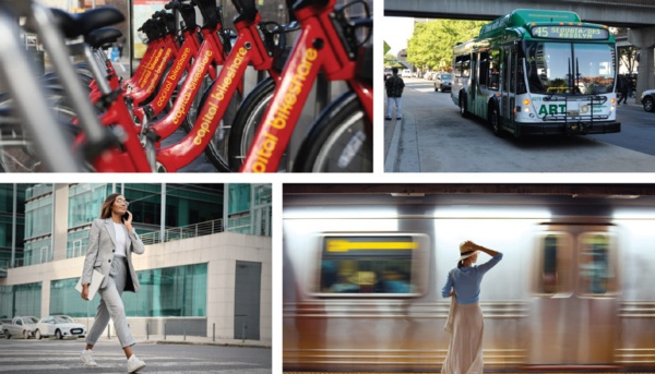
- Metro Rail & Metro Bus
a region-wide system of subways, above-ground trains and buses - Arlingon Transit & Other Local Buses
each jurisdiction operates its own local bus system, with easy connections to Metro - Commuter Buses
longer bus routes connecting commuters from outside the beltway to jobs in and around DC - Commuter Rail
longer train service connecting commuters to Union Station in DC - from either Maryland (MARC) or Virginia (VRE) - Intercity Rail & Bus
long-haul bus rides on services like Amtrak, Greyhound, and Bolt Bus - Walking
a healthy and environmentally-friendly way of getting around - Bicycling
a fun and easy way to travel, with hundreds of miles of bike trails and routes in the area, plus thousands of Capital Bikeshare bikes available to rent - Scooters
several companies offer convenient scooters for rent, with apps for paying and riding - Carpooling & Carsharing
reduce your auto expenses and driving time by carpooling, vanpooling, slugging or using Zipcar or peer-to-peer carsharing - Taxicabs, Uber, Lyft
good backup options for people who carpool, bike, walk or use public transportation - Paratransit & Accessible Transit
find special transportation services, elevators and fare discounts for people with disabilities. - Streetcars
ride along H Street and Benning Road in DC, from Union Station to Oklahoma Avenue